


Warren County PUMA, New Jersey
About
Outline

Summary
| Unique Area Identifier | 193406 |
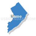
| Name | Warren County PUMA |
| State | New Jersey |
| Area (square miles) | 362.86 |
| Land Area (square miles) | 356.92 |
| Water Area (square miles) | 5.94 |
| % of Land Area | 98.36 |
| % of Water Area | 1.64 |
| Latitude of the Internal Point | 40.85352380 |
| Longtitude of the Internal Point | -75.00954210 |
Maps


Graphs
Select a template below for downloading or customizing gragh for Warren County PUMA, New Jersey


Neighbors
Neighoring Public Use Microdata Area (by Name) Neighboring Public Use Microdata Area on the Map
- Bucks County (North) PUMA, PA
- Hunterdon County PUMA, NJ
- Monroe County PUMA, PA
- Morris County (West) PUMA, NJ
- Northampton (South) & Lehigh (East) Counties--Bethlehem (East) & Easton Cities PUMA, PA
- Northampton County (North) PUMA, PA
- Sussex County PUMA, NJ
Top 10 Neighboring County (by Population) Neighboring County on the Map
- Bucks County, PA (625,249)
- Morris County, NJ (492,276)
- Northampton County, PA (297,735)
- Monroe County, PA (169,842)
- Sussex County, NJ (149,265)
- Hunterdon County, NJ (128,349)
- Warren County, NJ (108,692)
Top 10 Neighboring County Subdivision (by Population) Neighboring County Subdivision on the Map
- Mount Olive township, Morris County, NJ (28,117)
- Easton city, Northampton County, PA (26,800)
- Washington township, Morris County, NJ (18,533)
- Middle Smithfield township, Monroe County, PA (15,997)
- Phillipsburg town, Warren County, NJ (14,950)
- Forks township, Northampton County, PA (14,721)
- Hackettstown town, Warren County, NJ (9,724)
- Byram township, Sussex County, NJ (8,350)
- Lopatcong township, Warren County, NJ (8,014)
- Mansfield township, Warren County, NJ (7,725)
Top 10 Neighboring Place (by Population) Neighboring Place on the Map
- Easton city, PA (26,800)
- Phillipsburg town, NJ (14,950)
- Hackettstown town, NJ (9,724)
- Washington borough, NJ (6,461)
- Beattystown CDP, NJ (4,554)
- Panther Valley CDP, NJ (3,327)
- Greenwich CDP, NJ (2,755)
- Belvidere town, NJ (2,681)
- Alpha borough, NJ (2,369)
- Upper Pohatcong CDP, NJ (1,781)
Top 10 Neighboring Elementary School District (by Population) Neighboring Elementary School District on the Map
- Washington Township School District, NJ (18,533)
- Byram Township School District, NJ (8,350)
- Lopatcong Township School District, NJ (8,014)
- Mansfield Township School District, NJ (7,725)
- Blairstown Township School District, NJ (7,663)
- Washington Township School District, NJ (6,651)
- Lebanon Township School District, NJ (6,588)
- Washington Borough School District, NJ (6,461)
- Greenwich Township School District, NJ (5,712)
- Holland Township School District, NJ (5,291)
Top 10 Neighboring Secondary School District (by Population) Neighboring Secondary School District on the Map
- North Hunterdon-Voorhees Regional School District, NJ (51,047)
- West Morris Regional School District, NJ (38,870)
- Warren Hills Regional School District, NJ (24,013)
- Delaware Valley Regional School District, NJ (16,680)
- Lenape Valley Regional School District, NJ (15,192)
- Kittatinny Regional School District, NJ (14,746)
- North Warren Regional School District, NJ (12,948)
Top 10 Neighboring Unified School District (by Population) Neighboring Unified School District on the Map
- Easton Area School District, PA (63,870)
- East Stroudsburg Area School District, PA (47,915)
- Stroudsburg Area School District, PA (34,609)
- Mount Olive Township School District, NJ (28,117)
- Bangor Area School District, PA (22,655)
- Wilson Area School District, PA (15,477)
- Phillipsburg Town School District, NJ (14,950)
- Hackettstown Town School District, NJ (9,724)
- Great Meadows Regional School District, NJ (8,604)
- Belvidere Town School District, NJ (2,681)
Top 10 Neighboring State Legislative District Lower Chamber (by Population) Neighboring State Legislative District Lower Chamber on the Map
- General Assembly District 23, NJ (229,972)
- General Assembly District 24, NJ (215,703)
- State House District 189, PA (76,401)
- State House District 137, PA (72,979)
- State House District 136, PA (63,631)
- State House District 143, PA (62,909)
Top 10 Neighboring State Legislative District Upper Chamber (by Population) Neighboring State Legislative District Upper Chamber on the Map
- State Senate District 24, PA (278,648)
- State Senate District 20, PA (273,416)
- State Senate District 18, PA (267,805)
- State Senate District 23, NJ (229,972)
- State Senate District 24, NJ (215,703)
Top 10 Neighboring 111th Congressional District (by Population) Neighboring 111th Congressional District on the Map
- Congressional District 15, PA (721,828)
- Congressional District 11, PA (687,860)
- Congressional District 11, NJ (674,349)
- Congressional District 7, NJ (672,885)
- Congressional District 8, PA (672,685)
- Congressional District 5, NJ (666,551)
Top 10 Neighboring Census Tract (by Population) Neighboring Census Tract on the Map
- Census Tract 171.02, Northampton County, PA (8,584)
- Census Tract 322, Warren County, NJ (8,014)
- Census Tract 312, Warren County, NJ (7,949)
- Census Tract 315, Warren County, NJ (7,725)
- Census Tract 102, Hunterdon County, NJ (7,664)
- Census Tract 461.06, Morris County, NJ (7,616)
- Census Tract 319, Warren County, NJ (6,651)
- Census Tract 320, Warren County, NJ (6,461)
- Census Tract 181, Northampton County, PA (6,324)
- Census Tract 462.01, Morris County, NJ (6,129)
Top 10 Neighboring 5-Digit ZIP Code Tabulation Area (by Population) Neighboring 5-Digit ZIP Code Tabulation Area on the Map
- 18042, PA (41,570)
- 07840, NJ (29,849)
- 08865, NJ (29,840)
- 18301, PA (28,561)
- 07860, NJ (26,288)
- 18013, PA (17,802)
- 18302, PA (17,362)
- 18040, PA (15,742)
- 07882, NJ (14,492)
- 07828, NJ (14,150)